Redeeming the Saddest Historical Marker
If you passed by this historic marker on the side of the road, would you stop? It’s still about two hours to get back home. Once you’re back, you need to do unpack your car, do housework, schoolwork, and to top it off, you’re hungry.
I stopped.
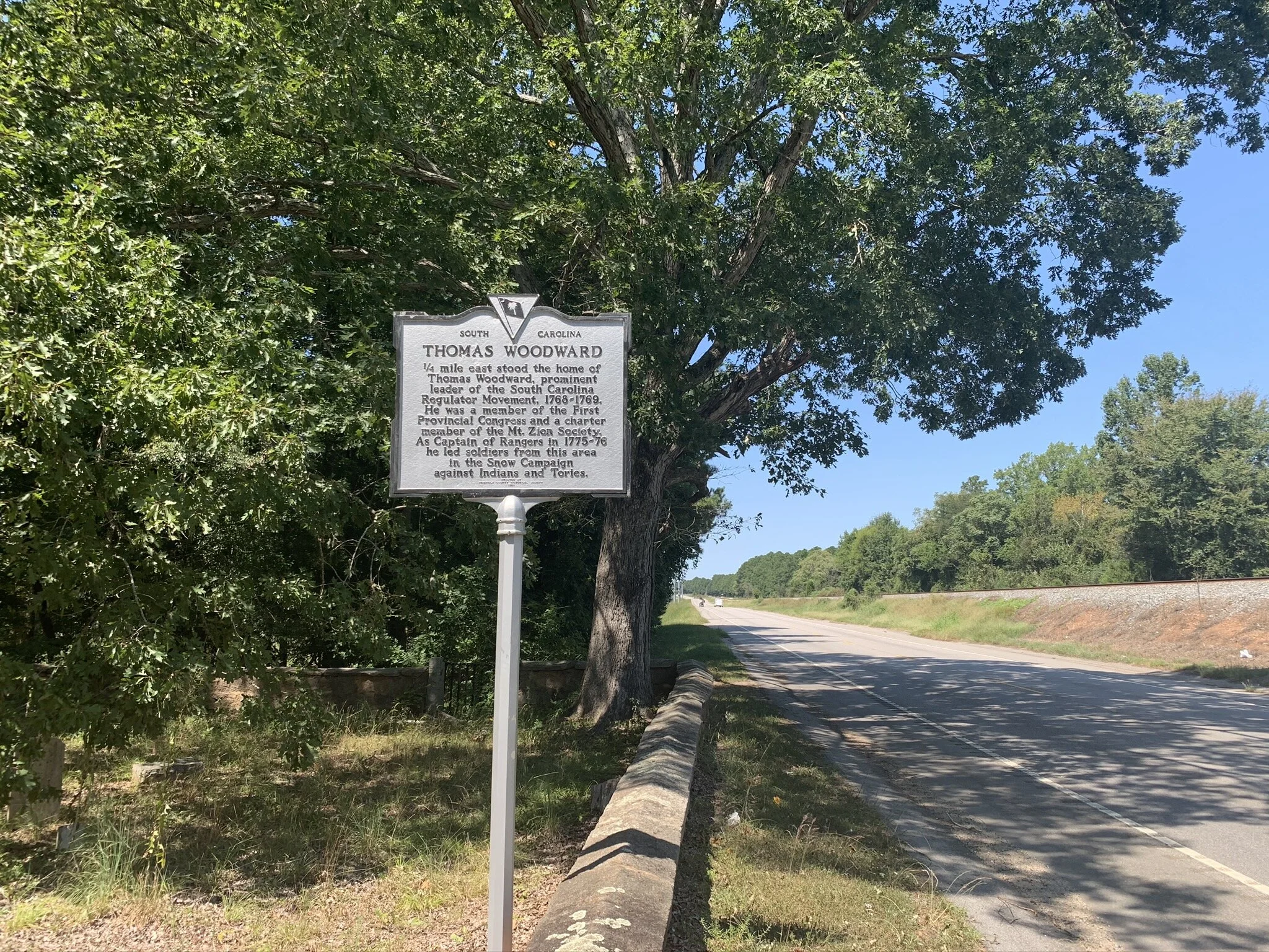
This tiny little marker and plot of land caught my attention…well, because it’s tiny. To be more specific, I was driving along Highway 34, an east-west road that connects a variety of cities across the middle of South Carolina. This marker is between the towns of Ridgeway and Winnsboro.
To give you a better idea of why I stopped, I want to show you a satellite picture of the area. Here it is:
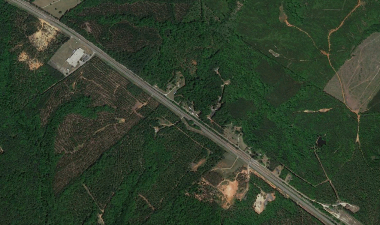
Do you see that little divot off the side of the road there? That’s the entirety of the historic site. What you can’t see is that there’s a long string of overhead power lines that follow the path of the highway. So when the site gets in the way of their path, the lines bend around it and keep going. And let’s not forget to mention the railroad tracks that run just on the other side of the road.
Using some Google Earth estimates, the site is about 470 feet wide, and 80 feet deep at the farthest-back point. Given the triangular shape, that means it’s roughly half an acre of land.
It’s clear that this site has been poorly maintained for years. Of course, there’s no parking, so you pull off to the side of the road and step out of your car.
You may have been able to guess it already, but this site is a family cemetery. There are upwards of two dozen gravestones littered around the place, all surrounded by a short brick wall.
This is where the story splits in three. There’s a surprising amount of information we can glean from this site. What do you want to learn more about?


